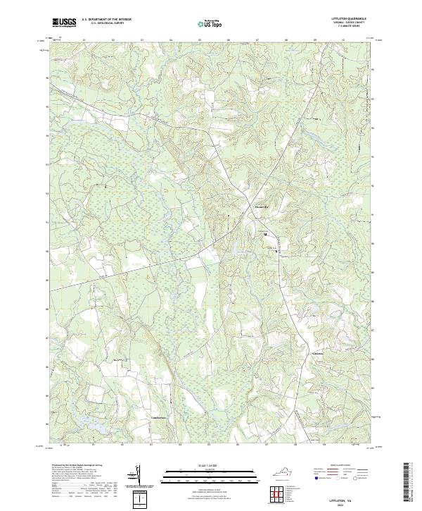
2022 Map of Littleton
USGS Topo · Published 2022About this map
Homeville and Littleton serve as the primary crossroads in this rural Sussex County landscape, where the meandering Nottoway River creates a broad, marshy basin dominated by Hunting Quarter Swamp. The area's settlement pattern is closely tied to its hydrology, with small communities and family cemeteries like Oakland Cem and Easter Cem situated on higher ground between the river and the extensive Assamoosick Swamp to the east. Historical transit is evidenced by the prominent Jerusalem Plank Rd, a corridor that bypasses the wetter lowlands of Mussel Swamp. The southern portion of the quadrangle shows the small settlement of Lumberton near Honey Pond, reflecting the timber-driven economy that has long defined this region of the Virginia coastal plain.
Find a feature on this map
45 named features on this map. Tap any name to fly to it.
Don’t see what you’re looking for? This feature index may not catch every label — zoom into the map to look around manually.
Map Details
Editions of this 2022 Littleton Map
This is the sole edition of this map. No revisions or reprints were ever made.
Other maps of this area

1894 · Petersburg
USGS Topo · 1:62,500

1919 · Jarratt
USGS Topo · 1:62,500

1919 · Disputanta
USGS Topo · 1:62,500

1919 · Homeville
USGS Topo · 1:48,000

1920 · Homeville
USGS Topo · 1:62,500

1943 · Sebrell
USGS Topo · 1:31,680

1943 · Manry
USGS Topo · 1:31,680

1943 · Littleton
USGS Topo · 1:31,680

1943 · Vicksville
USGS Topo · 1:31,680

1943 · Richmond
USGS Topo · 1:250,000