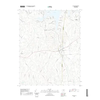
2019 Map of Littleton
USGS Topo · Published 2019About this map
The town of Littleton straddles the Warren Co and Halifax Co line, serving as a hub between the southern shores of Lake Gaston and the rural lands to the south. This 2019 survey documents a landscape defined by the tension between long-standing agricultural history and modern recreational development. Residential growth is evident along the lake's fingers, with named developments like Hubquarter Development and roads such as Tangle Oaks Dr and Raintree Dr branching toward the water. To the west, the village of Vaughan sits near the headwaters of Bens Cr, while the eastern side of the quadrangle is marked by Cooleys Crossroads. Local heritage is anchored by sites like Sunset Hill Cem and Macons Grave, providing specific coordinates for genealogists. The intricate drainage patterns of Butterwood Cr, Big Stone House Cr, and the waters of Panacea Springs illustrate the varied topography of the North Carolina Piedmont before it transitions toward the coastal plain.
Find a feature on this map
97 named features on this map. Tap any name to fly to it.
Don’t see what you’re looking for? This feature index may not catch every label — zoom into the map to look around manually.
Map Details
Editions of this 2019 Littleton Map
This is the sole edition of this map. No revisions or reprints were ever made.
Other maps of this area

1919 · White Plains
USGS Topo · 1:48,000

1920 · White Plains
USGS Topo · 1:62,500

1953 · Norfolk
USGS Topo · 1:250,000

1953 · Greensboro
USGS Topo · 1:250,000

1954 · Greensboro
USGS Topo · 1:250,000

1962 · Greensboro
USGS Topo · 1:250,000

1963 · Gasburg
USGS Topo · 1:24,000

1963 · Valentines
USGS Topo · 1:24,000

1966 · Greensboro
USGS Topo · 1:250,000

1968 · South Hill SE
USGS Topo · 1:24,000