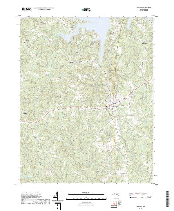
2022 Map of Littleton
USGS Topo · Published 2022About this map
Littleton serves as the primary hub on this sheet, situated along the CSX Transportation line and the border between Warren and Halifax counties. The landscape transitions from the developed inlets of Lake Gaston in the north to the more secluded drainages of Little Fishing Creek and Butterwood Creek to the south. Historically significant sites like Panacea Springs and Macons Grave point to the area's long-standing social and burial traditions, while small settlements such as Vaughan and Enterprise illustrate the traditional crossroads nature of the North Carolina Piedmont. The road network, including names like Nathaniel Macon Drive and John Alston Road, reflects deep-rooted family ties to the land. The presence of the Vaughan School and Roanoke Chapel provides localized points of interest for genealogists tracing community centers from the 20th century into the modern era.
Find a feature on this map
100 named features on this map. Tap any name to fly to it.
Don’t see what you’re looking for? This feature index may not catch every label — zoom into the map to look around manually.
Map Details
Editions of this 2022 Littleton Map
This is the sole edition of this map. No revisions or reprints were ever made.
Other maps of this area

1919 · White Plains
USGS Topo · 1:48,000

1920 · White Plains
USGS Topo · 1:62,500

1953 · Norfolk
USGS Topo · 1:250,000

1953 · Greensboro
USGS Topo · 1:250,000

1954 · Greensboro
USGS Topo · 1:250,000

1962 · Greensboro
USGS Topo · 1:250,000

1963 · Gasburg
USGS Topo · 1:24,000

1963 · Valentines
USGS Topo · 1:24,000

1966 · Greensboro
USGS Topo · 1:250,000

1968 · South Hill SE
USGS Topo · 1:24,000