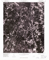
1977 Map of Littleton
USGS Topo · Published 1979About this map
Littleton serves as the primary hub on this 1970s orthophotoquad, showing the dense intersection of local roads and the town's built-up footprint during a period of established rural growth. The aerial perspective reveals a landscape of varied agricultural clearings and dense forest patches, bounded to the north by the massive waters of Lake Gaston. This man-made reservoir dominates the northern margin, where the shoreline's irregular inlets contrast sharply with the structured grid of the surrounding timber and farmlands. Smaller settlements like Vaughan to the west and Enterprise provide additional points of orientation within this North Carolina interior. The map captures the visual reality of the land as it stood in 1977, offering researchers a chance to see exact property clearings and forest boundaries that standard topographic line drawings often generalize.
Find a feature on this map
4 named features on this map. Tap any name to fly to it.
Don’t see what you’re looking for? This feature index may not catch every label — zoom into the map to look around manually.
Map Details
Editions of this 1977 Littleton Map
This is the sole edition of this map. No revisions or reprints were ever made.
Other maps of this area

1919 · White Plains
USGS Topo · 1:48,000

1920 · White Plains
USGS Topo · 1:62,500

1953 · Norfolk
USGS Topo · 1:250,000

1953 · Greensboro
USGS Topo · 1:250,000

1954 · Greensboro
USGS Topo · 1:250,000

1962 · Greensboro
USGS Topo · 1:250,000

1963 · Gasburg
USGS Topo · 1:24,000

1963 · Valentines
USGS Topo · 1:24,000

1966 · Greensboro
USGS Topo · 1:250,000

1968 · South Hill SE
USGS Topo · 1:24,000