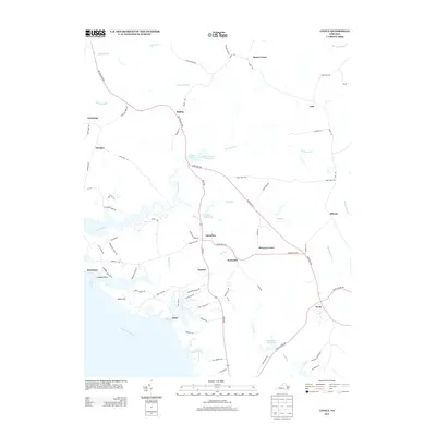
2013 Map of Lively
USGS Topo · Published 2013About this map
The Rappahannock River defines the southern edge of this coastal Virginia landscape, where numerous tidal creeks and swamps penetrate the low-lying interior. Small agricultural and residential nodes such as Nuttsville, Litwalton, and Lively are connected by the historic corridor of the Historyland Hwy. The map reveals a legacy of water management and local industry through features like Morattico Old Mill Pond, Balls Millpond, and Blakemore Millpond, indicating where early settlers harnessed the slow-moving waters of Lancaster Cr and Little Br. Along the riverfront, Colbert Point and the grounds of Belle Isle show the importance of the waterfront to the region's heritage. This modern survey provides a clear view of how traditional rural settlements like Robley, Lara, and Alfonso persist amid the extensive wetlands of Laton Swamp and Bellwood Swamp.
Find a feature on this map
79 named features on this map. Tap any name to fly to it.
Don’t see what you’re looking for? This feature index may not catch every label — zoom into the map to look around manually.
Map Details
Editions of this 2013 Lively Map
This is the sole edition of this map. No revisions or reprints were ever made.
Other maps of this area

1916 · Kilmarnock
USGS Topo · 1:48,000

1917 · Heathsville
USGS Topo · 1:48,000

1917 · Urbanna
USGS Topo · 1:62,500

1917 · Morattico
USGS Topo · 1:62,500

1917 · Kilmarnock
USGS Topo · 1:62,500

1918 · Morattico
USGS Topo · 1:62,500

1926 · Morattico
USGS Topo · 1:62,500

1942 · Kilmarnock
USGS Topo · 1:62,500

1943 · Richmond
USGS Topo · 1:250,000

1944 · Morattico
USGS Topo · 1:31,680