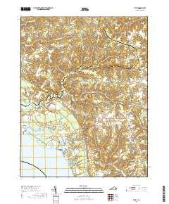
2019 Map of Lively
USGS Topo · Published 2019About this map
The Rappahannock River defines the western edge of this Northern Neck peninsula, where the landscape is carved by tidal creeks and historic millponds. The settlement at Belle Isle and the nearby community of Morattico anchor the waterfront, while the interior is marked by a network of crossroads and family-named landmarks including Somers, Nuttsville, and Lively. This coastal plain environment is characterized by significant water bodies such as Lancaster Creek, Balls Millpond, and Morattico Old Mill Pond, which points to the area's agricultural and industrial heritage. Numerous burial grounds, including Hopewell Cem, Beulah Cem, and Lebanon Cem, provide critical touchstones for genealogical research in this long-settled region of Lancaster and Richmond Counties. The map reveals a transition from the marshy lowlands of Laton Swamp to the upland ridges that connect these historic Virginia villages.
Find a feature on this map
98 named features on this map. Tap any name to fly to it.
Don’t see what you’re looking for? This feature index may not catch every label — zoom into the map to look around manually.
Map Details
Editions of this 2019 Lively Map
This is the sole edition of this map. No revisions or reprints were ever made.
Other maps of this area

1916 · Kilmarnock
USGS Topo · 1:48,000

1917 · Heathsville
USGS Topo · 1:48,000

1917 · Urbanna
USGS Topo · 1:62,500

1917 · Morattico
USGS Topo · 1:62,500

1917 · Kilmarnock
USGS Topo · 1:62,500

1918 · Morattico
USGS Topo · 1:62,500

1926 · Morattico
USGS Topo · 1:62,500

1942 · Kilmarnock
USGS Topo · 1:62,500

1943 · Richmond
USGS Topo · 1:250,000

1944 · Morattico
USGS Topo · 1:31,680