
1951 Map of Livengood
USGS Topo · Published 1952About this map
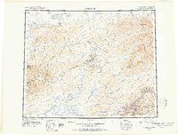
The Yukon River and the jagged peaks of the White Mountains anchor this 1951 reconnaissance map of interior Alaska. Placer mining and transport history are central to this landscape, with the Steese Highway and Elliott Highway providing primary access to remote settlements like Livengood and Chatanika. The map captures an era when the region’s economic pulse was tied to these road corridors and the mineral-rich gulches and pups of the local mining districts.
Find a feature on this map
125 named features on this map. Tap any name to fly to it.
Don’t see what you’re looking for? This feature index may not catch every label — zoom into the map to look around manually.
Map Details
Editions of this 1951 Livengood Map
2 editions found
Other maps of this area

1945 · Livengood
USGS Topo · 1:250,000

1948 · Kantishna River
USGS Topo · 1:250,000

1949 · Fairbanks D-1
USGS Topo · 1:62,500

1949 · Fairbanks D-2
USGS Topo · 1:62,500

1949 · Fairbanks D-3
USGS Topo · 1:63,360

1949 · Fairbanks D-4
USGS Topo · 1:63,360

1950 · Fairbanks
USGS Topo · 1:250,000

1950 · Big Delta
USGS Topo · 1:250,000

1950 · Big Delta D-6
USGS Topo · 1:63,360

1950 · Fairbanks D-5
USGS Topo · 1:63,360