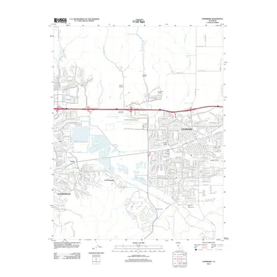
2012 Map of Livermore
USGS Topo · Published 2012About this map
The Livermore and Pleasanton area in the early 21st century reveals a landscape defined by the intersection of residential expansion and its deep-rooted viticultural heritage. In the Livermore Valley, the map shows a sophisticated agricultural economy where Retzlaff Vineyards, Fenestra Winery, and Livermore Valley Cellars Winery sit adjacent to growing suburban developments and the infrastructure of the Livermore Municipal Airport.
Find a feature on this map
171 named features on this map. Tap any name to fly to it.
Don’t see what you’re looking for? This feature index may not catch every label — zoom into the map to look around manually.
Map Details
Editions of this 2012 Livermore Map
This is the sole edition of this map. No revisions or reprints were ever made.
Other maps of this area

1896 · Mt. Diablo
USGS Topo · 1:62,500

1898 · Mt. Diablo
USGS Topo · 1:62,500

1906 · Pleasanton
USGS Topo · 1:62,500

1907 · Tesla
USGS Topo · 1:62,500

1911 · Byron Hot Springs
USGS Topo · 1:31,680

1916 · Byron Hot Springs
USGS Topo · 1:31,680

1916 · Byron
USGS Topo · 1:62,500

1940 · Byron
USGS Topo · 1:62,500

1941 · Pleasanton
USGS Topo · 1:62,500

1942 · Altamont
USGS Topo · 1:62,500