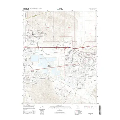
2015 Map of Livermore
USGS Topo · Published 2015About this map
The Amador Valley and Livermore Valley are documented here during a period of significant suburban expansion and infrastructure development. The urban centers of Livermore, Pleasanton, and Dublin dominate the valley floor, showing a dense network of residential streets and commercial corridors that connect these once-distinct ranching towns. Industrial and transport landmarks like the Livermore Municipal Airport and the complex of rail-adjacent sites at Radum and Asco illustrate the region's mid-century economic shift.
Find a feature on this map
39 named features on this map. Tap any name to fly to it.
Don’t see what you’re looking for? This feature index may not catch every label — zoom into the map to look around manually.
Map Details
Editions of this 2015 Livermore Map
This is the sole edition of this map. No revisions or reprints were ever made.
Other maps of this area

1896 · Mt. Diablo
USGS Topo · 1:62,500

1898 · Mt. Diablo
USGS Topo · 1:62,500

1906 · Pleasanton
USGS Topo · 1:62,500

1907 · Tesla
USGS Topo · 1:62,500

1911 · Byron Hot Springs
USGS Topo · 1:31,680

1916 · Byron Hot Springs
USGS Topo · 1:31,680

1916 · Byron
USGS Topo · 1:62,500

1940 · Byron
USGS Topo · 1:62,500

1941 · Pleasanton
USGS Topo · 1:62,500

1942 · Altamont
USGS Topo · 1:62,500