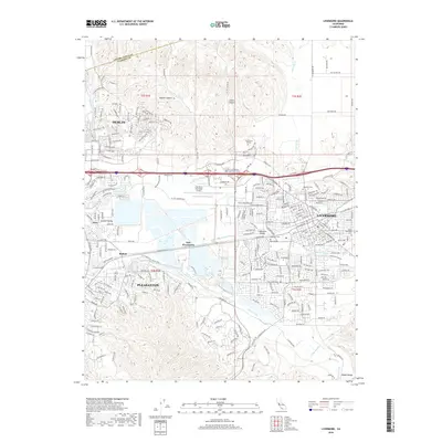
2018 Map of Livermore
USGS Topo · Published 2018About this map
Livermore and Pleasanton serve as the primary hubs in this survey, showcasing the continued suburban and industrial growth of the Tri-Valley region. The map reveals a landscape defined by water management and transit, where the S Bay Aqueduct and the Arroyo Valle traverse the terrain. Traces of older identities remain through settlements like Asco and Radum, while the sprawling residential developments of Dublin and Oak Knoll indicate modern expansion. Local education and aviation infrastructure are represented by Las Positas College and the Livermore Municipal Airport. Along the southern edge, the terrain rises into the Diablo Range, providing a sharp contrast to the developed valley floor. Genealogists will find the locations of St Michaels Cem, Roselawn Cem, and Oak Knoll Cem useful for family research in this part of Alameda County.
Find a feature on this map
287 named features on this map. Tap any name to fly to it.
Don’t see what you’re looking for? This feature index may not catch every label — zoom into the map to look around manually.
Map Details
Editions of this 2018 Livermore Map
This is the sole edition of this map. No revisions or reprints were ever made.
Other maps of this area

1896 · Mt. Diablo
USGS Topo · 1:62,500

1898 · Mt. Diablo
USGS Topo · 1:62,500

1906 · Pleasanton
USGS Topo · 1:62,500

1907 · Tesla
USGS Topo · 1:62,500

1911 · Byron Hot Springs
USGS Topo · 1:31,680

1916 · Byron Hot Springs
USGS Topo · 1:31,680

1916 · Byron
USGS Topo · 1:62,500

1940 · Byron
USGS Topo · 1:62,500

1941 · Pleasanton
USGS Topo · 1:62,500

1942 · Altamont
USGS Topo · 1:62,500