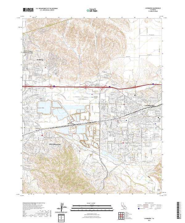
2021 Map of Livermore
USGS Topo · Published 2021About this map
The Amador Valley and Livermore Valley are documented here in a contemporary state of dense suburban development and active infrastructure. This map highlights the significant urbanization of the Tri-Valley region, where Dublin, Pleasanton, and Livermore have expanded to nearly continuous settlement. Connectivity is a defining theme, shown through the complex road network including Dublin Blvd and Stanley Blvd, alongside the enduring route of the Southern Pacific railroad. Natural drainage remains visible through the winding paths of Arroyo Mocho and Arroyo Las Positas, even as they are flanked by modern industrial sites and the Livermore Municipal Airport. Local heritage and community landmarks are anchored by several notable grounds, including Roselawn Cem, Oak Knoll Cem, and Saint Michaels Cem, which serve as important reference points for genealogists tracking local families.
Find a feature on this map
168 named features on this map. Tap any name to fly to it.
Don’t see what you’re looking for? This feature index may not catch every label — zoom into the map to look around manually.
Map Details
Editions of this 2021 Livermore Map
This is the sole edition of this map. No revisions or reprints were ever made.
Other maps of this area

1896 · Mt. Diablo
USGS Topo · 1:62,500

1898 · Mt. Diablo
USGS Topo · 1:62,500

1906 · Pleasanton
USGS Topo · 1:62,500

1907 · Tesla
USGS Topo · 1:62,500

1911 · Byron Hot Springs
USGS Topo · 1:31,680

1916 · Byron Hot Springs
USGS Topo · 1:31,680

1916 · Byron
USGS Topo · 1:62,500

1940 · Byron
USGS Topo · 1:62,500

1941 · Pleasanton
USGS Topo · 1:62,500

1942 · Altamont
USGS Topo · 1:62,500