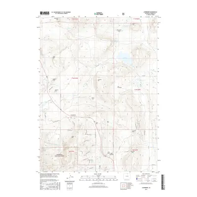
2016 Map of Livermore
USGS Topo · Published 2016About this map
Livermore sits at a geographic crossroads in northern Colorado, where the transition from high plains to mountain foothills is marked by dramatic terrain and water management systems. This 2016 survey highlights a landscape dominated by ranching heritage and modern conservation, featuring the eastern edge of the Roosevelt National Forest and the winding N Fork Cache La Poudre River. A notable point of local history is the Eddie Hale Grave, located south of Gage Hill near Bonner Peak.
Find a feature on this map
53 named features on this map. Tap any name to fly to it.
Don’t see what you’re looking for? This feature index may not catch every label — zoom into the map to look around manually.
Map Details
Editions of this 2016 Livermore Map
This is the sole edition of this map. No revisions or reprints were ever made.
Other maps of this area

1906 · Fort Collins
USGS Topo · 1:62,500

1907 · Livermore
USGS Topo · 1:125,000

1908 · Fort Collins
USGS Topo · 1:62,500

1909 · Livermore
USGS Topo · 1:125,000

1954 · Greeley
USGS Topo · 1:250,000

1957 · Greeley
USGS Topo · 1:250,000

1958 · Greeley
USGS Topo · 1:250,000

1960 · Livermore
USGS Topo · 1:24,000
1960 · Buckeye
USGS Topo · 1:24,000
1960 · Wellington
USGS Topo · 1:24,000