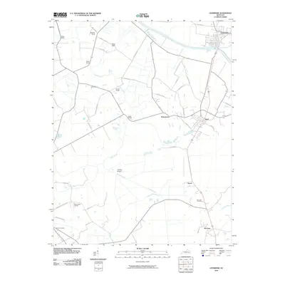
2010 Map of Livermore
USGS Topo · Published 2010About this map
The confluence of the Green River and the lowlands of Cypress Creek define the landscape around Livermore, Kentucky, in the early 21st century. The map illustrates a region where local geography is tied to specific families and historical crossings, evidenced by a series of named spans including Vicker Bridge, Bryant Bridge, and Stroud Bridge. The settlement pattern follows the elevation, with the village of Island and the community of Buttonsberry situated on slightly higher ground above the expansive Cypress Bottom. Higher points such as Boehler Knob and Bates Knob rise above the drainage basins, providing landmarks for a network of country roads like Bates Hollow Rd and Revlett-Stroud Rd. For the local historian, the map details established sites like New Hope Cemetery and Shavers Cemetery, alongside the David Lowe Airport, reflecting the long-term evolution of McLean County’s infrastructure.
Find a feature on this map
40 named features on this map. Tap any name to fly to it.
Don’t see what you’re looking for? This feature index may not catch every label — zoom into the map to look around manually.
Map Details
Editions of this 2010 Livermore Map
This is the sole edition of this map. No revisions or reprints were ever made.
Other maps of this area

1906 · Sutherland
USGS Topo · 1:62,500

1908 · Calhoun
USGS Topo · 1:62,500

1909 · Madisonville
USGS Topo · 1:62,500

1909 · Central City
USGS Topo · 1:62,500

1952 · Equality
USGS Topo · 1:24,000

1952 · Livermore
USGS Topo · 1:24,000

1952 · Sacramento
USGS Topo · 1:24,000

1952 · Calhoun
USGS Topo · 1:24,000

1953 · Central City West
USGS Topo · 1:24,000

1953 · Central City East
USGS Topo · 1:24,000