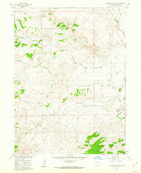
1960 Map of Livermore Mountain
USGS Topo · Published 1970About this map
Livermore (Old Site) and the nearby Livermore Cem serve as focal points for this 1960 Larimer County survey, capturing the ranching and mountainous character of northern Colorado. The drainage of the North Fork Cache la Poudre River shapes the local topography, joined by major tributaries including Rabbit Creek and Lone Pine Creek. The landscape transitions from the open terrain around Calloway Hill to the protected boundaries of the Roosevelt National Forest in the south.
Find a feature on this map
15 named features on this map. Tap any name to fly to it.
Don’t see what you’re looking for? This feature index may not catch every label — zoom into the map to look around manually.
Map Details
Editions of this 1960 Livermore Mountain Map
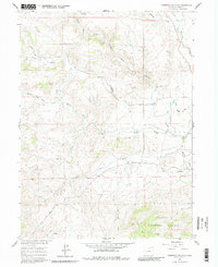
Other maps of this area

1906 · Fort Collins
USGS Topo · 1:62,500

1907 · Livermore
USGS Topo · 1:125,000

1908 · Fort Collins
USGS Topo · 1:62,500

1909 · Livermore
USGS Topo · 1:125,000

1954 · Greeley
USGS Topo · 1:250,000

1957 · Greeley
USGS Topo · 1:250,000

1958 · Greeley
USGS Topo · 1:250,000

1960 · Livermore
USGS Topo · 1:24,000

1960 · Haystack Gulch
USGS Topo · 1:24,000

1960 · Livermore Mountain
USGS Topo · 1:24,000