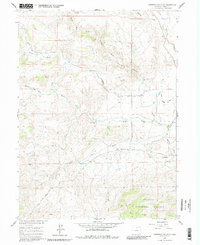
1960 Map of Livermore Mountain
USGS Topo · Published 1980About this map
Livermore (Old Site) serves as a primary historical anchor in this northern Colorado landscape, located where the North Fork Cache la Poudre River meets the plains. The 1960 field-check captures a transition in water management and land use, evidenced by the presence of the North Poudre Canal, an aqueduct, and a spillway near North Fork Rabbit Creek. To the south, the terrain rises toward Livermore Mtn and the eastern boundaries of the Roosevelt National Forest. This survey is particularly useful for genealogists and local historians, as it precisely locates the Livermore Cem and traces the original routes of the Cherokee Park Road and Red Feather Lakes Road before modern realignments. The drainage patterns of Stonewall Creek and Lone Tree Creek define the ranching country surrounding the old settlement.
Find a feature on this map
19 named features on this map. Tap any name to fly to it.
Don’t see what you’re looking for? This feature index may not catch every label — zoom into the map to look around manually.
Map Details
Editions of this 1960 Livermore Mountain Map
Other maps of this area

1906 · Fort Collins
USGS Topo · 1:62,500

1907 · Livermore
USGS Topo · 1:125,000

1908 · Fort Collins
USGS Topo · 1:62,500

1909 · Livermore
USGS Topo · 1:125,000

1954 · Greeley
USGS Topo · 1:250,000

1957 · Greeley
USGS Topo · 1:250,000

1958 · Greeley
USGS Topo · 1:250,000

1960 · Livermore
USGS Topo · 1:24,000

1960 · Haystack Gulch
USGS Topo · 1:24,000

1960 · Livermore Mountain
USGS Topo · 1:24,000