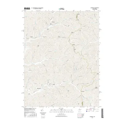
2016 Map of Liverpool
USGS Topo · Published 2016About this map
Wiseburg and Lockhart anchor the northern reaches of this Jackson County landscape, where the terrain is defined by the winding drainages of the Left Fork Sandy Creek and Lockhart Fork. The 2016 survey documents a rural West Virginia territory concentrated on agricultural homesteads and traditional cemeteries that reveal the area's genealogical depth. Numerous family and community burial grounds, such as Sheppard Chapel Church Cem and Pleasant Ridge Church Cem, are situated along high elevations like Limestone Ridge and Garfield Ridge. Moving south toward Liverpool, the landscape follows the Right Fork Sandy Creek, connecting small settlements like Meadowdale and Duncan. This map provides a detailed look at the modern road network, including Parkersburg Rd and Liverpool Rd, which weave through the complex network of hollows and ridges.
Find a feature on this map
105 named features on this map. Tap any name to fly to it.
Don’t see what you’re looking for? This feature index may not catch every label — zoom into the map to look around manually.
Map Details
Editions of this 2016 Liverpool Map
This is the sole edition of this map. No revisions or reprints were ever made.
Other maps of this area

1906 · Elizabeth
USGS Topo · 1:62,500

1906 · Belleville
USGS Topo · 1:62,500

1907 · Spencer
USGS Topo · 1:62,500

1907 · Ripley
USGS Topo · 1:62,500

1924 · Belleville
USGS Topo · 1:62,500

1924 · Elizabeth
USGS Topo · 1:62,500

1926 · Elizabeth
USGS Topo · 1:62,500

1926 · Belleville
USGS Topo · 1:62,500

1926 · Ripley
USGS Topo · 1:62,500

1928 · Spencer
USGS Topo · 1:62,500