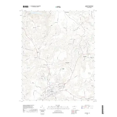
2019 Map of Livingston
USGS Topo · Published 2019About this map
The town of Livingston serves as the focal point of this Overton County landscape, where the plateau terrain is deeply incised by the drainage basins of Big Eagle Creek and Nettlecarrier Creek. This modern survey illustrates the persistent rural settlement patterns of the Upper Cumberland, with small communities such as Allons, Monroe, and Independence connected by a network of winding mountain roads. A significant number of family and community burial grounds, including Walnut Grove Cemetery, Good Hope Cemetery, and Nelson Cemetery, are scattered across the ridges and hollows, providing essential data for genealogical research. The geography is defined by prominent elevations like Schoolhouse Mountain and Palestine Mountain, while the northern edge of the map reaches the waters of Dale Hollow Lake. Industrial and transport infrastructure is represented by the Livingston Municipal Airport and the historic site of Garretts Mill.
Find a feature on this map
150 named features on this map. Tap any name to fly to it.
Don’t see what you’re looking for? This feature index may not catch every label — zoom into the map to look around manually.
Map Details
Editions of this 2019 Livingston Map
This is the sole edition of this map. No revisions or reprints were ever made.
Other maps of this area

1897 · Standingstone
USGS Topo · 1:125,000

1898 · Standingstone
USGS Topo · 1:125,000

1924 · Lillydale
USGS Topo · 1:62,500

1926 · Lillydale
USGS Topo · 1:62,500

1929 · Lillydale
USGS Topo · 1:62,500

1929 · Byrdstown
USGS Topo · 1:62,500

1944 · Livingston
USGS Topo · 1:24,000

1951 · Windle
USGS Topo · 1:24,000

1954 · Crawford
USGS Topo · 1:24,000
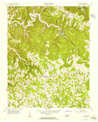
1955 · Hilham
USGS Topo · 1:24,000