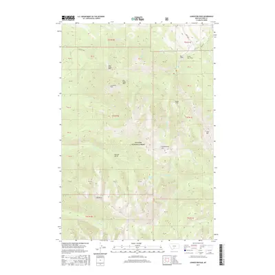
2017 Map of Livingston Peak
USGS Topo · Published 2017About this map
Livingston Peak and the high ridges of the Absaroka Range dominate this part of the Gallatin National Forest. This 2017 study captures a landscape defined by significant elevation changes and alpine basins, including West Baldy Basin and East Baldy Basin. The area is a critical watershed for the Yellowstone River valley, with drainage networks like Mission Cr and Suce Cr carving deep into the mountain front. Unlike more developed regions, the footprint of human infrastructure here is limited to the periphery, such as Bruffey Ln and Bruffey Rd in the northeast. Notable summits such as Elephanthead Mtn, Mt Delano, and Shell Mtn provide fixed reference points for navigating the complex topography. Small alpine features like Blacktail Lake and numerous draws, including Rough Draw and Little Bear Draw, illustrate the intricate seasonal water movement through these high-altitude ranges.
Find a feature on this map
33 named features on this map. Tap any name to fly to it.
Don’t see what you’re looking for? This feature index may not catch every label — zoom into the map to look around manually.
Map Details
Editions of this 2017 Livingston Peak Map
This is the sole edition of this map. No revisions or reprints were ever made.
Other maps of this area

1891 · Livingston
USGS Topo · 1:250,000

1893 · Livingston
USGS Topo · 1:250,000

1940 · Mt. Cowen
USGS Topo · 1:62,500

1943 · Mt Cowen
USGS Topo · 1:62,500

1947 · Bozeman
USGS Topo · 1:250,000

1948 · Bozeman
USGS Topo · 1:250,000

1951 · Mount Rae
USGS Topo · 1:24,000

1951 · Brisbin
USGS Topo · 1:24,000

1951 · Livingston Peak
USGS Topo · 1:24,000

1951 · Elton
USGS Topo · 1:24,000