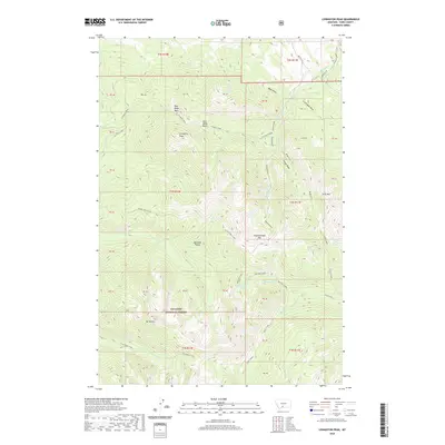
2020 Map of Livingston Peak
USGS Topo · Published 2020About this map
The Absaroka Range dominates this section of Gallatin National Forest, defining a high-altitude landscape of sharp peaks and drainage basins. High points like Livingston Peak and Mt Delano overlook a complex network of waterways, including Suce Creek and the N Fork Deep Creek. The map shows the distinct transition from the steep alpine terrain of Elephanthead Mtn to the more gradual slopes of the West Baldy Basin and East Baldy Basin.
Find a feature on this map
50 named features on this map. Tap any name to fly to it.
Don’t see what you’re looking for? This feature index may not catch every label — zoom into the map to look around manually.
Map Details
Editions of this 2020 Livingston Peak Map
This is the sole edition of this map. No revisions or reprints were ever made.
Other maps of this area

1891 · Livingston
USGS Topo · 1:250,000

1893 · Livingston
USGS Topo · 1:250,000

1940 · Mt. Cowen
USGS Topo · 1:62,500

1943 · Mt Cowen
USGS Topo · 1:62,500

1947 · Bozeman
USGS Topo · 1:250,000

1948 · Bozeman
USGS Topo · 1:250,000

1951 · Mount Rae
USGS Topo · 1:24,000

1951 · Brisbin
USGS Topo · 1:24,000

1951 · Livingston Peak
USGS Topo · 1:24,000

1951 · Elton
USGS Topo · 1:24,000