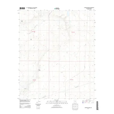
2013 Map of Livingston Ridge
USGS Topo · Published 2013About this map
Maroon Cliffs and the prominent Livingston Ridge define this high desert landscape in Eddy County, where the terrain transitions into the geologic depression of Nash Draw. This 2013 survey by the U. S. Geological Survey details an area dominated by modern energy and infrastructure, indicated by the network of heavy-use routes like Wipp Rd and Delaware Basin Rd. The map documents the specific locations of essential water catchments such as New Tank, Noye Tank, and Hill Tank, which are critical landmarks for navigation in this arid region. Traces of older transit ways are also present, most notably the Cimarron Trl, which cuts across the southern portion of the quadrangle. The lack of traditional town centers highlights the region's character as a specialized industrial and resource-based landscape.
Find a feature on this map
13 named features on this map. Tap any name to fly to it.
Don’t see what you’re looking for? This feature index may not catch every label — zoom into the map to look around manually.
Map Details
Editions of this 2013 Livingston Ridge Map
This is the sole edition of this map. No revisions or reprints were ever made.
Other maps of this area

1939 · Nash Draw
USGS Topo · 1:62,500

1942 · Clayton Basin
USGS Topo · 1:62,500

1943 · Clayton Basin
USGS Topo · 1:62,500

1943 · Nash Draw
USGS Topo · 1:62,500

1954 · Hobbs
USGS Topo · 1:250,000

1958 · Hobbs
USGS Topo · 1:250,000

1963 · Laguna Gatuna
USGS Topo · 1:62,500

1963 · Hat Mesa
USGS Topo · 1:62,500

1978 · Jal
USGS Topo · 1:100,000
1984 · Bootleg Ridge
USGS Topo · 1:24,000