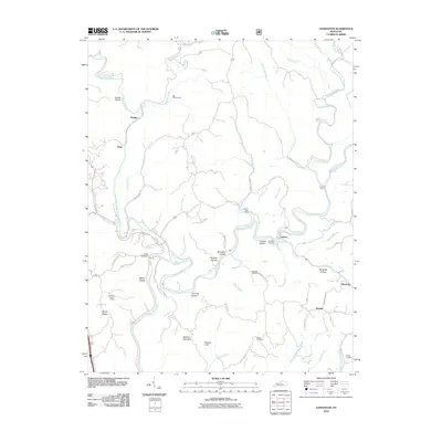
2010 Map of Livingston
USGS Topo · Published 2010About this map
The Rockcastle River snakes through this landscape, defining the topography of Rockcastle County as it was recorded in 2010. The terrain is characterized by a dense network of hollows and ridges, such as Boone Hollow, Jennings Hollow, and the prominent Wildcat Mountain. Small communities and post offices like Lamero and Mullins are connected by a web of rural routes, including the historically named Old Wilderness Rd. This survey captures the rural infrastructure of the early 21st century, showing the persistence of traditional river crossings like the Cruise Ferry and the observation point at Sand Hill Lookout Tower. Numerous family burial grounds, such as Jep Hill Cemetery and Robinson Cemetery, are scattered across the ridges, providing a clear map for genealogists tracing ancestral homesteads in the rugged hills near Symbol and Mershons.
Find a feature on this map
62 named features on this map. Tap any name to fly to it.
Don’t see what you’re looking for? This feature index may not catch every label — zoom into the map to look around manually.
Map Details
Editions of this 2010 Livingston Map
This is the sole edition of this map. No revisions or reprints were ever made.
Other maps of this area

1893 · London
USGS Topo · 1:125,000

1897 · London
USGS Topo · 1:125,000

1952 · Billows
USGS Topo · 1:24,000

1952 · Bernstadt
USGS Topo · 1:24,000

1952 · London
USGS Topo · 1:24,000

1953 · Johnetta
USGS Topo · 1:24,000

1953 · Sandgap
USGS Topo · 1:24,000

1953 · Wildie
USGS Topo · 1:24,000

1953 · Livingston
USGS Topo · 1:24,000

1953 · Mount Vernon
USGS Topo · 1:24,000