
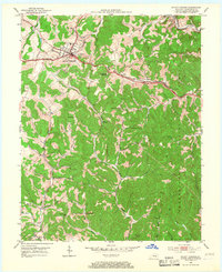
1953 Map of Mount Vernon
USGS Topo · Published 1954About this map
Mount Vernon serves as the focal point of this Rockcastle County terrain, where the historic Wilderness Road and the Louisville and Nashville Road converge. The landscape is defined by the deep valleys of Roundstone Creek and Skegg Creek, with the eastern portions of the map protected within the Cumberland National Forest. The presence of the Louisville and Nashville railroad line, featuring a station at Orlando (Brush Creek Sta), underscores the importance of the rail corridor to this region's economy and development.
Find a feature on this map
42 named features on this map. Tap any name to fly to it.
Don’t see what you’re looking for? This feature index may not catch every label — zoom into the map to look around manually.
Map Details
Editions of this 1953 Mount Vernon Map
2 editions found
Other maps of this area

1893 · London
USGS Topo · 1:125,000

1897 · London
USGS Topo · 1:125,000

1952 · Billows
USGS Topo · 1:24,000

1952 · Shopville
USGS Topo · 1:24,000

1952 · Bernstadt
USGS Topo · 1:24,000

1953 · Johnetta
USGS Topo · 1:24,000

1953 · Maretburg
USGS Topo · 1:24,000

1953 · Wildie
USGS Topo · 1:24,000

1953 · Livingston
USGS Topo · 1:24,000
1953 · Brodhead
USGS Topo · 1:24,000