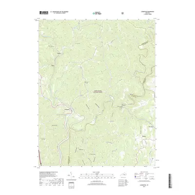
2019 Map of Livingston
USGS Topo · Published 2019About this map
The Rockcastle River carves a deep path through this portion of the Daniel Boone National Forest, defining the rugged borderlands between Rockcastle, Jackson, and Laurel counties. The town of Livingston serves as a central point where the river meets the winding corridor of the railroad, surrounded by a landscape marked by steep ridges and named hollows like Ford Hollow and Walton Hollow. This modern survey records the enduring footprint of rural Appalachian settlement, preserved in a network of family and community burial grounds such as Jep Hill Cem and Morning View Church Cem. The terrain is dominated by prominent heights like Wildcat Mtn and Hoosier Knob, while the Sheltowee Trace NRT long-distance trail follows the high ground above Horse Lick Creek and Roundstone Creek.
Find a feature on this map
55 named features on this map. Tap any name to fly to it.
Don’t see what you’re looking for? This feature index may not catch every label — zoom into the map to look around manually.
Map Details
Editions of this 2019 Livingston Map
This is the sole edition of this map. No revisions or reprints were ever made.
Other maps of this area

1893 · London
USGS Topo · 1:125,000

1897 · London
USGS Topo · 1:125,000

1952 · Billows
USGS Topo · 1:24,000

1952 · Bernstadt
USGS Topo · 1:24,000

1952 · London
USGS Topo · 1:24,000

1953 · Johnetta
USGS Topo · 1:24,000

1953 · Sandgap
USGS Topo · 1:24,000

1953 · Wildie
USGS Topo · 1:24,000

1953 · Livingston
USGS Topo · 1:24,000

1953 · Mount Vernon
USGS Topo · 1:24,000