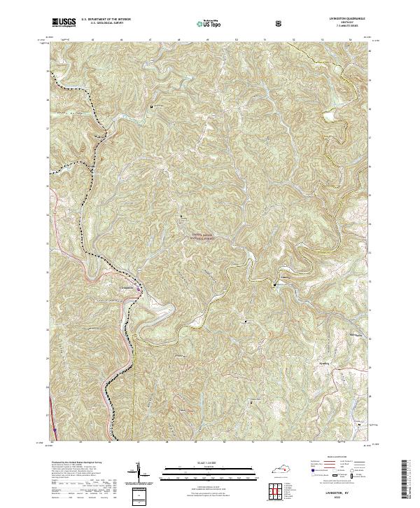
2022 Map of Livingston
USGS Topo · Published 2022About this map
The Rockcastle River snakes through this Kentucky landscape, forming the natural border between Rockcastle and Laurel counties. At its bend sits Livingston, the primary settlement in a region defined by steep hollows and high ridges. The area is heavily marked by its recreational and conservation history, with much of the terrain falling within the Daniel Boone National Forest and traversed by the Sheltoee Trace Trl.
Find a feature on this map
59 named features on this map. Tap any name to fly to it.
Don’t see what you’re looking for? This feature index may not catch every label — zoom into the map to look around manually.
Map Details
Editions of this 2022 Livingston Map
This is the sole edition of this map. No revisions or reprints were ever made.
Other maps of this area

1893 · London
USGS Topo · 1:125,000

1897 · London
USGS Topo · 1:125,000

1952 · Billows
USGS Topo · 1:24,000

1952 · Bernstadt
USGS Topo · 1:24,000

1952 · London
USGS Topo · 1:24,000

1953 · Johnetta
USGS Topo · 1:24,000

1953 · Sandgap
USGS Topo · 1:24,000

1953 · Wildie
USGS Topo · 1:24,000

1953 · Livingston
USGS Topo · 1:24,000

1953 · Mount Vernon
USGS Topo · 1:24,000