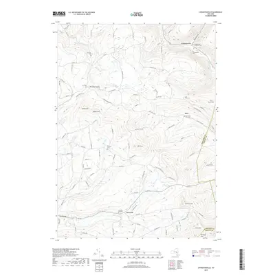
2019 Map of Livingstonville
USGS Topo · Published 2019About this map
Livingstonville sits at the junction of Catskill Creek and several mountain roads, serving as a focal point for this section of the Schoharie Valley. The landscape is defined by its numerous small settlements and the persistent presence of early regional history, marked by family and community burial grounds such as the Livingstonville Presbyterian Cemetery and the Scott Patent Cemetery. Steep elevations like Steenburg Mountain and High Knob channel the local waterways, including the Manor Kill and Keyser Kill, which have shaped the settlement patterns of Manorkill and Bates for generations.
Find a feature on this map
97 named features on this map. Tap any name to fly to it.
Don’t see what you’re looking for? This feature index may not catch every label — zoom into the map to look around manually.
Map Details
Editions of this 2019 Livingstonville Map
This is the sole edition of this map. No revisions or reprints were ever made.
Other maps of this area

1893 · Durham
USGS Topo · 1:62,500

1894 · Durham
USGS Topo · 1:62,500

1898 · Schoharie
USGS Topo · 1:62,500

1900 · Schoharie
USGS Topo · 1:62,500

1900 · Berne
USGS Topo · 1:62,500

1901 · Gilboa
USGS Topo · 1:62,500

1903 · Gilboa
USGS Topo · 1:62,500

1903 · Berne
USGS Topo · 1:62,500

1943 · Breakabeen
USGS Topo · 1:24,000
1944 · Middleburgh
USGS Topo · 1:24,000