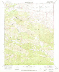
1969 Map of Llanada
USGS Topo · Published 1972About this map
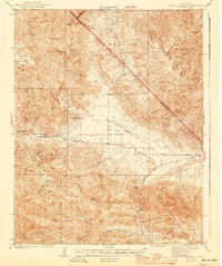
Panoche Valley defines the northern reaches of this territory, where the small settlement of Llanada sits along the road near a network of pipelines. The landscape is dominated by the high ridges of Cerro Bonito and prominent summits like Walker Peak and Meyers Peak. This 1969 field-checked survey reveals an area defined by its water sources and rugged drainages, from the winding path of Panoche Creek to the numerous named canyons like Clough Canyon, Moody Canyon, and Log Cabin Canyon. Local history and genealogy interest is anchored at the Cherry Hill Cem and by family-named landmarks including Albañez Spring, Parrot Spring, and Moody Sulphur Spring. Evidence of local industry and infrastructure appears in the form of a Landing Strip, several mines, and scattered prospects throughout the southern canyons near Pimental Creek.
Find a feature on this map
30 named features on this map. Tap any name to fly to it.
Don’t see what you’re looking for? This feature index may not catch every label — zoom into the map to look around manually.
Map Details
Editions of this 1969 Llanada Map
This is the sole edition of this map. No revisions or reprints were ever made.
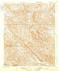
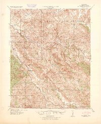
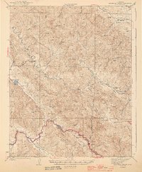
Other maps of this area

1913 · Panoche
USGS Topo · 1:125,000

1915 · Priest Valley
USGS Topo · 1:125,000

1919 · San Benito
USGS Topo · 1:62,500

1921 · Metz
USGS Topo · 1:62,500
1931 · San Benito
USGS Topo · 1:62,500

1940 · Metz
USGS Topo · 1:62,500
1940 · San Benito
USGS Topo · 1:62,500

1943 · Hernandez Valley
USGS Topo · 1:62,500
1944 · Hernandez Valley
USGS Topo · 1:62,500
1944 · Panoche Valley
USGS Topo · 1:62,500