
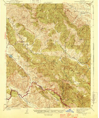
1944 Map of Hernandez Valley
USGS Topo · Published 1944About this map
Bitterwater Valley and the Peach Tree Valley define the southwest of this 1941 survey, showing a landscape of remote ranches and specialized infrastructure. The presence of the Fire Flex Mine near Pine Mtn and an Oil Pumping Sta near the Garcia Ranch suggests the mid-century industrial interests being pursued in these hills. Scattered throughout the drainage basins of the San Benito River and the Hernandez River are small educational hubs like Hernandez Sch and Bitterwater-Tully Sch, which served the isolated agricultural families at settlements like Lemoak and Kenner. The topography transitions from the Griswold Hills in the northeast across the Syncline Divide, illustrating a complex network of canyons including Mustang Canyon and Devils Canyon that historically dictated the routes of local travel.
Find a feature on this map
63 named features on this map. Tap any name to fly to it.
Don’t see what you’re looking for? This feature index may not catch every label — zoom into the map to look around manually.
Map Details
Editions of this 1944 Hernandez Valley Map
2 editions found
Other maps of this area

1913 · Panoche
USGS Topo · 1:125,000

1915 · Priest Valley
USGS Topo · 1:125,000

1919 · King City
USGS Topo · 1:62,500

1919 · San Benito
USGS Topo · 1:62,500

1921 · Metz
USGS Topo · 1:62,500

1931 · San Benito
USGS Topo · 1:62,500

1939 · King City
USGS Topo · 1:62,500

1940 · Metz
USGS Topo · 1:62,500

1940 · San Benito
USGS Topo · 1:62,500

1941 · Priest Valley
USGS Topo · 1:62,500