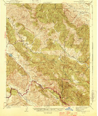
1944 Map of Hernandez Valley
USGS Topo · Published 1944About this map
Bitterwater Valley and the surrounding San Benito County high country are defined by a network of isolated ranches and small rural schools in this mid-century survey. The landscape is dominated by the San Benito River and Hernandez River, which carve through a complex series of ridges including San Lorenzo Ridge and Griswold Hills. Local education was anchored by the Hernandez Sch and Bitterwater Tully Sch, serving the families who managed the large landholdings here.
Find a feature on this map
50 named features on this map. Tap any name to fly to it.
Don’t see what you’re looking for? This feature index may not catch every label — zoom into the map to look around manually.
Map Details
Editions of this 1944 Hernandez Valley Map
2 editions found

Other maps of this area

1913 · Panoche
USGS Topo · 1:125,000

1915 · Priest Valley
USGS Topo · 1:125,000

1919 · King City
USGS Topo · 1:62,500

1919 · San Benito
USGS Topo · 1:62,500

1921 · Metz
USGS Topo · 1:62,500

1931 · San Benito
USGS Topo · 1:62,500

1939 · King City
USGS Topo · 1:62,500

1940 · Metz
USGS Topo · 1:62,500

1940 · San Benito
USGS Topo · 1:62,500

1941 · Priest Valley
USGS Topo · 1:62,500