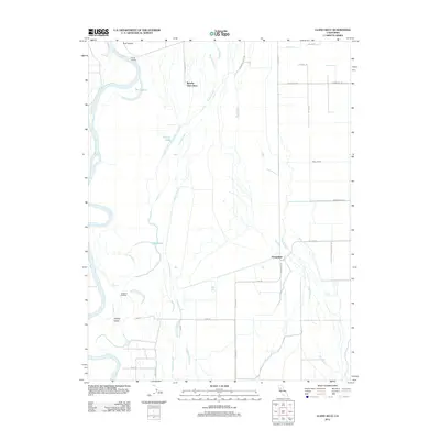
2012 Map of Llano Seco
USGS Topo · Published 2012About this map
The Rancho Llano Seco land grant dominates this landscape along the eastern bank of the Sacramento River south of Chico. This area is defined by a complex network of seasonal waterways and irrigation infrastructure, including the branching fingers of Angel Slough, Campbell Slough, and Little Chico Cr. The presence of Parrott Landing and Newhard Landing along the river's edge points to the historical importance of the water for transport and trade in this agricultural region. Inland, the map details the transition from natural sloughs to engineered water management, visible in the straight lines of the Odell Canal and Western Canal. Small settlements like Dodgeland sit amidst a grid of rural roads such as Grainland Rd and Seven Mile Ln, reflecting a landscape built on large-scale ranching and farming. Notable water bodies like The Lagoon, Perkins Lake, and Eddy Lake dot the wetlands between the river and the valley floor.
Find a feature on this map
32 named features on this map. Tap any name to fly to it.
Don’t see what you’re looking for? This feature index may not catch every label — zoom into the map to look around manually.
Map Details
Editions of this 2012 Llano Seco Map
This is the sole edition of this map. No revisions or reprints were ever made.
Other maps of this area

1888 · Marysville
USGS Topo · 1:125,000

1891 · Chico
USGS Topo · 1:125,000

1891 · Marysville
USGS Topo · 1:125,000

1893 · Chico
USGS Topo · 1:125,000

1894 · Marysville
USGS Topo · 1:125,000

1895 · Marysville
USGS Topo · 1:125,000

1895 · Chico
USGS Topo · 1:125,000

1906 · Maxwell
USGS Topo · 1:62,500

1906 · Willows
USGS Topo · 1:62,500

1911 · Landlow
USGS Topo · 1:31,680