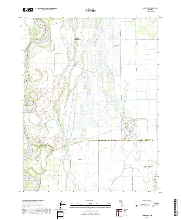
2022 Map of Llano Seco
USGS Topo · Published 2022About this map
Rancho Llano Seco anchor this part of the Central Sacramento Valley, where a complex network of wetlands and waterways defines the landscape. The Sacramento River winds along the western edge, creating landforms like Ryan Island and Hartley Island, while internal drainage is managed by a dense system of sloughs and canals. Features such as Angel Slough, Burnham Slough, and Campbell Slough weave through the terrain, illustrating the intricate hydrology of the region. The infrastructure reflects a blend of conservation and water management, evidenced by the Llano Seco Unit Trl and major irrigation arteries like the Western Canal and Odell Canal. This map provides a clear view of the rural road network, from named routes like Ord Ferry Rd to the straight alignments of Seven Mile Rd, tracing the boundary between Butte and Glenn counties.
Find a feature on this map
37 named features on this map. Tap any name to fly to it.
Don’t see what you’re looking for? This feature index may not catch every label — zoom into the map to look around manually.
Map Details
Editions of this 2022 Llano Seco Map
This is the sole edition of this map. No revisions or reprints were ever made.
Other maps of this area

1888 · Marysville
USGS Topo · 1:125,000

1891 · Chico
USGS Topo · 1:125,000

1891 · Marysville
USGS Topo · 1:125,000

1893 · Chico
USGS Topo · 1:125,000

1894 · Marysville
USGS Topo · 1:125,000

1895 · Marysville
USGS Topo · 1:125,000

1895 · Chico
USGS Topo · 1:125,000

1906 · Maxwell
USGS Topo · 1:62,500

1906 · Willows
USGS Topo · 1:62,500

1911 · Landlow
USGS Topo · 1:31,680