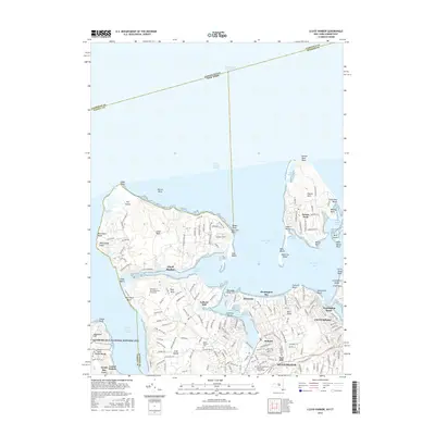
2016 Map of Lloyd Harbor
USGS Topo · Published 2016About this map
The North Shore of Long Island is defined here by the deep indentations of Huntington Bay and Northport Bay, creating a complex network of peninsulas and sheltered harbors. The expansive Lloyd Neck is anchored by the settlement of Lloyd Harbor, while to the east, Eatons Neck is nearly severed from the mainland by the Eatons Neck Basin. This landscape is marked by its coastal heritage and the preservation of significant estates, most notably the Sagamore Hill National Historic Site near Cove Neck.
Find a feature on this map
69 named features on this map. Tap any name to fly to it.
Don’t see what you’re looking for? This feature index may not catch every label — zoom into the map to look around manually.
Map Details
Editions of this 2016 Lloyd Harbor Map
This is the sole edition of this map. No revisions or reprints were ever made.
Other maps of this area

1892 · Stamford
USGS Topo · 1:62,500

1892 · Norwalk
USGS Topo · 1:62,500

1893 · Stamford
USGS Topo · 1:62,500

1893 · Norwalk
USGS Topo · 1:62,500

1897 · Oyster Bay
USGS Topo · 1:62,500

1898 · Oyster Bay
USGS Topo · 1:62,500

1899 · Stamford
USGS Topo · 1:62,500

1900 · Oyster Bay
USGS Topo · 1:62,500

1901 · Northport
USGS Topo · 1:62,500

1903 · Northport
USGS Topo · 1:62,500