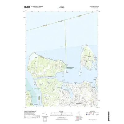
2019 Map of Lloyd Harbor
USGS Topo · Published 2019About this map
Sagamore Hill National Historic Site and the surrounding Gold Coast estates anchor this coastal survey, where the complex geography of the North Shore meets the Long Island Sound. The map documents a landscape defined by its deep harbors and protected points, including Lloyd Neck and the narrow, winding roads of Eatons Neck. Historic land use is evident in the inclusion of Lefferts Mill and local landmarks like the Seminary of the Immaculate Conception.
Find a feature on this map
196 named features on this map. Tap any name to fly to it.
Don’t see what you’re looking for? This feature index may not catch every label — zoom into the map to look around manually.
Map Details
Editions of this 2019 Lloyd Harbor Map
This is the sole edition of this map. No revisions or reprints were ever made.
Other maps of this area

1892 · Stamford
USGS Topo · 1:62,500

1892 · Norwalk
USGS Topo · 1:62,500

1893 · Stamford
USGS Topo · 1:62,500

1893 · Norwalk
USGS Topo · 1:62,500

1897 · Oyster Bay
USGS Topo · 1:62,500

1898 · Oyster Bay
USGS Topo · 1:62,500

1899 · Stamford
USGS Topo · 1:62,500

1900 · Oyster Bay
USGS Topo · 1:62,500

1901 · Northport
USGS Topo · 1:62,500

1903 · Northport
USGS Topo · 1:62,500