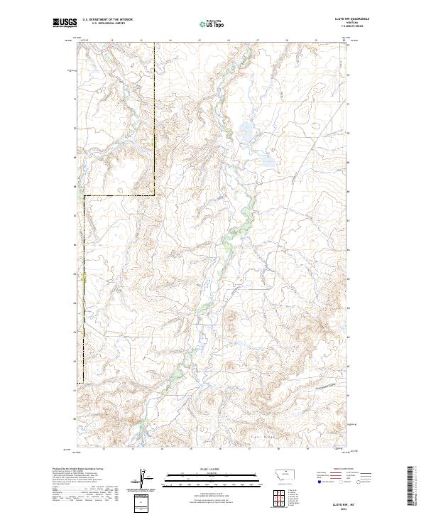
2024 Map of Lloyd NW
USGS Topo · Published 2024About this map
Tiger Ridge defines the southern reaches of this landscape, where the terrain breaks into a series of drainages and coulees along the Hill Co / Blaine Co line. The hydrology of the region is centered on the winding path of Clear Creek, which is supported by several seasonal tributaries including Grasshopper Coulee and Daveys Coulee. This modern topographic survey illustrates a sparsely settled ranching or grazing environment in north-central Montana, characterized by long-established section lines and isolated rural routes. Access through the hills is provided by a network of local roads such as Clear Creek Rd and Logie Rd, which trace the natural contours of the land. In the northern sections, Little Boxelder Creek and Three Mile Creek carve distinct paths through the high plains, indicating a drainage pattern typical of the Missouri River watershed's northern fringes.
Find a feature on this map
18 named features on this map. Tap any name to fly to it.
Don’t see what you’re looking for? This feature index may not catch every label — zoom into the map to look around manually.
Map Details
Editions of this 2024 Lloyd NW Map
This is the sole edition of this map. No revisions or reprints were ever made.
Other maps of this area

1904 · Yantic
USGS Topo · 1:62,500

1904 · Havre
USGS Topo · 1:62,500

1912 · Zurich
USGS Topo · 1:125,000

1912 · Thibedeau Lake
USGS Topo · 1:125,000

1953 · Havre
USGS Topo · 1:250,000

1956 · Lloyd
USGS Topo · 1:62,500

1957 · Havre
USGS Topo · 1:250,000

1958 · Havre
USGS Topo · 1:250,000

1959 · Shambo
USGS Topo · 1:62,500

1964 · Havre SE
USGS Topo · 1:24,000