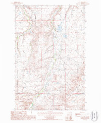
1987 Map of Lloyd NW
USGS Topo · Published 1987About this map
Tiger Ridge defines the southern reach of this landscape along the border of Hill and Blaine Counties in the late 1980s. The terrain is deeply incised by drainage networks, including Clear Creek and Boxelder Creek, which carve through the high plains toward Grasshopper Goulee. A central pipeline and a Pumping Station indicate the region's role in local energy infrastructure, while Staff Reservoir and scattered Springs highlight the essential water management required for this arid environment. A lone School in the northeast quadrant and numerous unnamed landmarks suggest a sparse, rural ranching or utility-focused community where geography dictated the patterns of settlement.
Find a feature on this map
13 named features on this map. Tap any name to fly to it.
Don’t see what you’re looking for? This feature index may not catch every label — zoom into the map to look around manually.
Map Details
Editions of this 1987 Lloyd NW Map
This is the sole edition of this map. No revisions or reprints were ever made.
Other maps of this area

1904 · Yantic
USGS Topo · 1:62,500

1904 · Havre
USGS Topo · 1:62,500

1912 · Zurich
USGS Topo · 1:125,000

1912 · Thibedeau Lake
USGS Topo · 1:125,000

1953 · Havre
USGS Topo · 1:250,000

1956 · Lloyd
USGS Topo · 1:62,500

1957 · Havre
USGS Topo · 1:250,000

1958 · Havre
USGS Topo · 1:250,000

1959 · Shambo
USGS Topo · 1:62,500

1964 · Havre SE
USGS Topo · 1:24,000