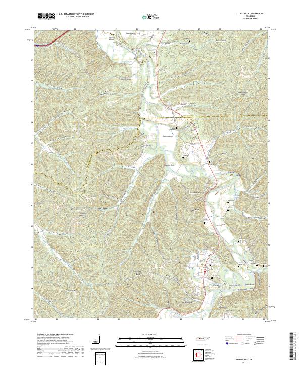
2022 Map of Lobelville
USGS Topo · Published 2022About this map
Lobelville anchors this survey of the Buffalo River valley in Perry County, where the river's winding course creates a series of fertile bottomlands and distinctive bends. The landscape is defined by the sharp transition between these lowlands, such as Leeper Bottom and Owen Bottom, and the deeply etched hollows of the surrounding ridges. Dozens of small-scale drainages like Seedtick Cr and Red Bank Cr feed the main river, while numerous springs—including Pruette Spring, Ledbetter Spring, and Spout Spring—emerge from the base of the hills. Local genealogy is well-documented through a dense concentration of family burial grounds, including the Leeper Cem, Dodson Cem, and Tate Cem, which sit atop the higher ground overlooking the river's floodplains. Unique landmarks like Standing Rock and the topographic divide at Dividing Ridge highlight the complex terrain of middle Tennessee.
Find a feature on this map
128 named features on this map. Tap any name to fly to it.
Don’t see what you’re looking for? This feature index may not catch every label — zoom into the map to look around manually.
Map Details
Editions of this 2022 Lobelville Map
This is the sole edition of this map. No revisions or reprints were ever made.
Other maps of this area

1936 · Pleasantville
USGS Topo · 1:24,000

1936 · Hurricane Mills
USGS Topo · 1:24,000

1936 · Coble
USGS Topo · 1:24,000

1936 · Pine View
USGS Topo · 1:24,000

1936 · Daniels Landing
USGS Topo · 1:24,000

1936 · Bucksnort
USGS Topo · 1:24,000

1936 · Chestnut Grove
USGS Topo · 1:24,000

1936 · Lobelville
USGS Topo · 1:24,000

1936 · Hustburg
USGS Topo · 1:24,000

1949 · Daniels Landing
USGS Topo · 1:24,000