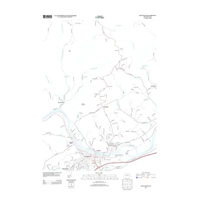
2013 Map of Lock Haven
USGS Topo · Published 2013About this map
The West Br Susquehanna River flows through the heart of this region, separating the city of Lock Haven and Flemington from the northern banks at Lockport and Dunnstown. This river corridor serves as the primary axis for development, housing the William T Piper Memorial Airport on the south bank near the large, distinctive Great Island. To the north, the landscape rises into the ridges of Simcox Mountain and Cole Hill, where smaller settlements like Swissdale and Queens Run are found among a network of smaller waterways including Big Plum Run and East Br Queens Run. The presence of the Tall Pines Airfield further north and reservoirs such as Number One Reservoir indicates a transition from the industrial and municipal center at the river toward more specialized rural land use and resource management.
Find a feature on this map
166 named features on this map. Tap any name to fly to it.
Don’t see what you’re looking for? This feature index may not catch every label — zoom into the map to look around manually.
Map Details
Editions of this 2013 Lock Haven Map
This is the sole edition of this map. No revisions or reprints were ever made.
Other maps of this area

1921 · Howard
USGS Topo · 1:48,000

1921 · Lock Haven
USGS Topo · 1:62,500

1923 · Howard
USGS Topo · 1:62,500

1923 · Lock Haven
USGS Topo · 1:62,500

1935 · Waterville
USGS Topo · 1:24,000

1937 · Waterville
USGS Topo · 1:48,000

1943 · Hyner
USGS Topo · 1:62,500

1943 · Waterville
USGS Topo · 1:62,500

1944 · Lock Haven
USGS Topo · 1:62,500

1946 · Renovo East
USGS Topo · 1:62,500