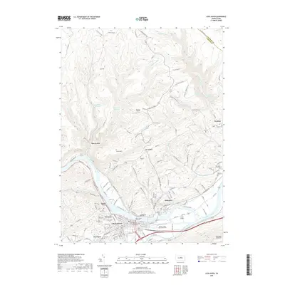
2019 Map of Lock Haven
USGS Topo · Published 2019About this map
The West Branch Susquehanna River defines the landscape of this river-valley region, where the urban center of Lock Haven serves as a focal point for Clinton County. The convergence of Bald Eagle Creek and the river creates a complex hydrology surrounding Great Island, a prominent landmass in the river's path. Infrastructure and institutional history are evident in the presence of the Haven University of Pennsylvania and the Clinton County Courthouse, while the aviation legacy of the area is marked by the William T Piper Memorial Airport.
Find a feature on this map
53 named features on this map. Tap any name to fly to it.
Don’t see what you’re looking for? This feature index may not catch every label — zoom into the map to look around manually.
Map Details
Editions of this 2019 Lock Haven Map
This is the sole edition of this map. No revisions or reprints were ever made.
Other maps of this area

1921 · Howard
USGS Topo · 1:48,000

1921 · Lock Haven
USGS Topo · 1:62,500

1923 · Howard
USGS Topo · 1:62,500

1923 · Lock Haven
USGS Topo · 1:62,500

1935 · Waterville
USGS Topo · 1:24,000

1937 · Waterville
USGS Topo · 1:48,000

1943 · Hyner
USGS Topo · 1:62,500

1943 · Waterville
USGS Topo · 1:62,500

1944 · Lock Haven
USGS Topo · 1:62,500

1946 · Renovo East
USGS Topo · 1:62,500