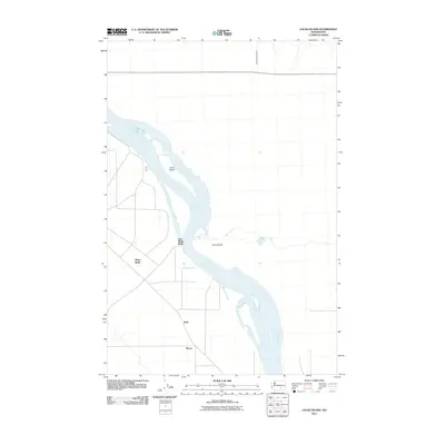
2011 Map of Locke Island
USGS Topo · Published 2011About this map
Columbia River currents dominate this 2011 survey, carving a path past the prominent Locke Island and the elevated terrain of White Bluffs. The landscape exhibits a sparse settlement pattern characteristic of this portion of Benton County, where established locations like Ruth and Pierce appear as nodes within a network of local roads. The geography is defined by the sharp contrast between the river valley and the rising elevations of East White Bluffs. Water management is evident through the presence of the White Bluffs Wasteway in the northeast, indicating the area's integration into larger regional irrigation and drainage systems. This map captures a specific moment in the modern evolution of the Hanford Reach, showing the proximity of small named settlements to the natural landmarks that have long defined travel and habitation along the river.
Find a feature on this map
8 named features on this map. Tap any name to fly to it.
Don’t see what you’re looking for? This feature index may not catch every label — zoom into the map to look around manually.
Map Details
Editions of this 2011 Locke Island Map
This is the sole edition of this map. No revisions or reprints were ever made.
Other maps of this area

1911 · Red Rock
USGS Topo · 1:62,500

1916 · Coyote Rapids
USGS Topo · 1:62,500

1923 · Corfu
USGS Topo · 1:62,500

1924 · Hanford
USGS Topo · 1:62,500

1950 · Smyrna
USGS Topo · 1:62,500

1951 · Smyrna
USGS Topo · 1:62,500

1951 · Corfu
USGS Topo · 1:62,500

1951 · Hanford
USGS Topo · 1:62,500

1951 · Coyote Rapids
USGS Topo · 1:62,500

1953 · Walla Walla
USGS Topo · 1:250,000