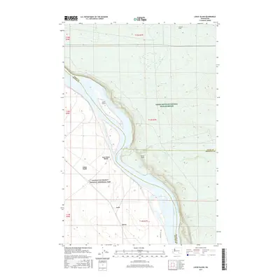
2017 Map of Locke Island
USGS Topo · Published 2017About this map
The Hanford Reach of the Columbia River flows through a landscape defined by significant 20th-century history and conservation efforts. This area contains the Manhattan Project National Historical Park, which commemorates the industrial complex that transformed this region. The map preserves the locations of early 20th-century settlements like White Bluffs and East White Bluffs, as well as the smaller communities of Ruth and Pierce, most of which were evacuated during the war years.
Find a feature on this map
22 named features on this map. Tap any name to fly to it.
Don’t see what you’re looking for? This feature index may not catch every label — zoom into the map to look around manually.
Map Details
Editions of this 2017 Locke Island Map
This is the sole edition of this map. No revisions or reprints were ever made.
Other maps of this area

1911 · Red Rock
USGS Topo · 1:62,500

1916 · Coyote Rapids
USGS Topo · 1:62,500

1923 · Corfu
USGS Topo · 1:62,500

1924 · Hanford
USGS Topo · 1:62,500

1950 · Smyrna
USGS Topo · 1:62,500

1951 · Smyrna
USGS Topo · 1:62,500

1951 · Corfu
USGS Topo · 1:62,500

1951 · Hanford
USGS Topo · 1:62,500

1951 · Coyote Rapids
USGS Topo · 1:62,500

1953 · Walla Walla
USGS Topo · 1:250,000