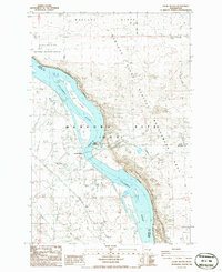
1986 Map of Locke Island
USGS Topo · Published 1986About this map
Columbia River waters dominate this mid-1980s landscape at the intersection of Grant, Benton, and Franklin counties. The river flows past Locke Island and beneath the prominent White Bluffs, a region increasingly dedicated to conservation and government oversight. Large tracts of land are designated as the Saddle Mountain National Wildlife Refuge and the Habitat Management Site (DOE), reflecting the complex environmental and technical management of the Hanford area.
Find a feature on this map
24 named features on this map. Tap any name to fly to it.
Don’t see what you’re looking for? This feature index may not catch every label — zoom into the map to look around manually.
Map Details
Editions of this 1986 Locke Island Map
This is the sole edition of this map. No revisions or reprints were ever made.
Other maps of this area

1911 · Red Rock
USGS Topo · 1:62,500

1916 · Coyote Rapids
USGS Topo · 1:62,500

1923 · Corfu
USGS Topo · 1:62,500

1924 · Hanford
USGS Topo · 1:62,500

1950 · Smyrna
USGS Topo · 1:62,500

1951 · Smyrna
USGS Topo · 1:62,500

1951 · Corfu
USGS Topo · 1:62,500

1951 · Hanford
USGS Topo · 1:62,500

1951 · Coyote Rapids
USGS Topo · 1:62,500

1953 · Walla Walla
USGS Topo · 1:250,000