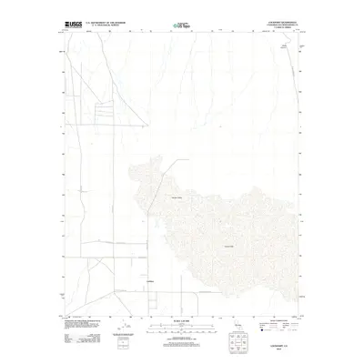
2012 Map of Lockhart
USGS Topo · Published 2012About this map
Harper Lake dominates this High Desert landscape, its vast dry bed stretching across the central portion of the quadrangle. The settlement of Lockhart sits just to the west of the lake bed, served by a network of rural routes including Lockhart Ranch Rd and Hoffman Rd. This area of San Bernardino County reflects the sparse, utilitarian layout of California’s arid interior, where the road system follows a rigid grid that eventually gives way to the natural contours of Harper Valley. To the northeast, the terrain ascends into Black Canyon, where Black Canyon Rd traces the path of a wash through the higher elevations. The map details a quiet agricultural and homesteading corridor defined by long straight stretches of road like Harper Lake Rd and Edie Rd.
Find a feature on this map
12 named features on this map. Tap any name to fly to it.
Don’t see what you’re looking for? This feature index may not catch every label — zoom into the map to look around manually.
Map Details
Editions of this 2012 Lockhart Map
This is the sole edition of this map. No revisions or reprints were ever made.
Other maps of this area

1915 · Searles Lake
USGS Topo · 1:250,000

1932 · Barstow
USGS Topo · 1:125,000

1934 · Barstow
USGS Topo · 1:125,000

1947 · Trona
USGS Topo · 1:250,000

1948 · Trona
USGS Topo · 1:250,000

1953 · San Bernardino
USGS Topo · 1:250,000

1953 · Trona
USGS Topo · 1:250,000

1955 · Opal Mountain
USGS Topo · 1:62,500

1956 · San Bernardino
USGS Topo · 1:250,000

1956 · Fremont Peak
USGS Topo · 1:62,500