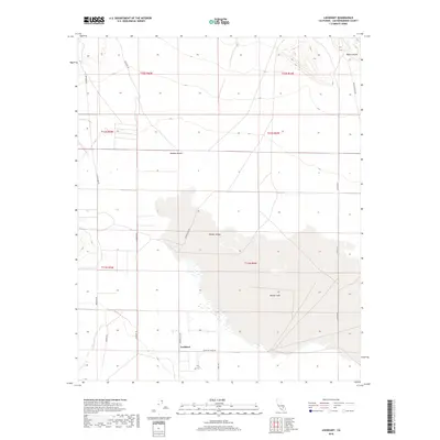
2018 Map of Lockhart
USGS Topo · Published 2018About this map
Harper Lake dominates this portion of the Mojave Desert, serving as a focal point for the surrounding Harper Valley. The settlement of Lockhart is situated at the western edge of the lake bed, near the junction of Lockhart Rd and Lockhart Ranch Rd. This desert landscape is defined by a grid of rural routes including Kramer Rd and Hoffman Rd, which provide access to the flat expanses of the valley floor and the rising terrain toward Black Canyon in the northeast. The presence of these named ranch roads and the identified settlement area suggests a history of localized desert agriculture or ranching centered around the intermittent water resources of the basin. The map detail reflects a transition from the stark topography of the canyon to the managed parcels and irrigation-dependent infrastructure of the valley sink.
Find a feature on this map
20 named features on this map. Tap any name to fly to it.
Don’t see what you’re looking for? This feature index may not catch every label — zoom into the map to look around manually.
Map Details
Editions of this 2018 Lockhart Map
This is the sole edition of this map. No revisions or reprints were ever made.
Other maps of this area

1915 · Searles Lake
USGS Topo · 1:250,000

1932 · Barstow
USGS Topo · 1:125,000

1934 · Barstow
USGS Topo · 1:125,000

1947 · Trona
USGS Topo · 1:250,000

1948 · Trona
USGS Topo · 1:250,000

1953 · San Bernardino
USGS Topo · 1:250,000

1953 · Trona
USGS Topo · 1:250,000

1955 · Opal Mountain
USGS Topo · 1:62,500

1956 · San Bernardino
USGS Topo · 1:250,000

1956 · Fremont Peak
USGS Topo · 1:62,500