2024 Map of Lockport
USGS Topo · Published 2024About this map
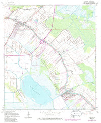
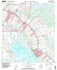
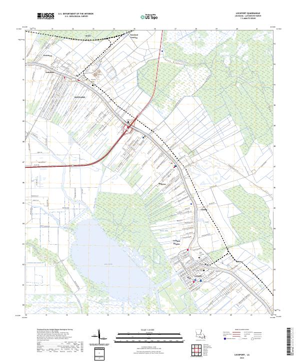
Bayou Lafourche defines the cultural and geographic backbone of this Cajun heartland, where settlements follow the natural levees of the waterway. The land-use pattern reveals the classic long-lot survey system, particularly visible near Raceland and Lockport, reflecting early French colonial heritage where every homestead required water access. Between the bayou and the expansive Lake Fields, the landscape transitions into wetlands marked by the Bayou Cut Off and Bayou Jollet. Local history is anchored by numerous spiritual and burial sites, including the Holy Savior Cem and Morning Star Cem. The transition from the higher ground of Love Ridge to the surrounding basins illustrates the careful engineering of the Godchaux Canal and the reliance on the primary corridor for commerce and community life in settlements like Mathews and Clotilda.
Find a feature on this map
140 named features on this map. Tap any name to fly to it.
Don’t see what you’re looking for? This feature index may not catch every label — zoom into the map to look around manually.
Map Details
Editions of this 2024 Lockport Map
This is the sole edition of this map. No revisions or reprints were ever made.
Historical Maps of Mathews Through Time
3 maps found