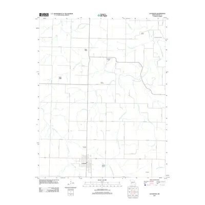
2011 Map of Lockwood
USGS Topo · Published 2011About this map
Lockwood serves as the primary hub of this Dade County landscape, situated where the terrain begins to yield to the many branches of the Sons Creek and Horse Creek systems. The map captures a well-established rural network defined by family-named landmarks and local burial grounds, including Messick Cemetery and Montgomery Cemetery in the northeast and Immanuel Cemetery just north of the township. A mix of small settlements like Sims Point and Dumbeck are connected by a grid of county roads that navigate local topographical features such as Grays Valley. The presence of Woodfield Airport and the Number 790 Dam indicates the modern infrastructure supporting this agricultural region. Genealogists will find the density of named cemeteries and clearly marked property boundaries useful for tracing late 20th and early 21st-century land use and family residency patterns.
Find a feature on this map
54 named features on this map. Tap any name to fly to it.
Don’t see what you’re looking for? This feature index may not catch every label — zoom into the map to look around manually.
Map Details
Editions of this 2011 Lockwood Map
This is the sole edition of this map. No revisions or reprints were ever made.
Other maps of this area

1886 · Nevada
USGS Topo · 1:125,000

1886 · Stockton
USGS Topo · 1:125,000

1886 · Greenfield
USGS Topo · 1:125,000

1886 · Carthage
USGS Topo · 1:125,000

1888 · Greenfield
USGS Topo · 1:125,000

1894 · Nevada
USGS Topo · 1:125,000

1894 · Carthage
USGS Topo · 1:125,000

1947 · Joplin
USGS Topo · 1:250,000

1949 · Joplin
USGS Topo · 1:250,000

1954 · Springfield
USGS Topo · 1:250,000