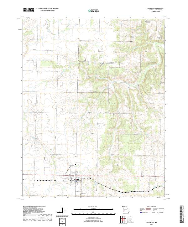
2021 Map of Lockwood
USGS Topo · Published 2021About this map
Lockwood anchors this Dade County landscape, serving as a hub for the surrounding agricultural region. The town's grid is detailed down to individual structures and street names, with Coose Field and Immanuel Cem located on its northern edge. Beyond the town center, the terrain is defined by a dense network of country roads, including State Rd VV and BB Hwy, which connect disparate homesteads and family burial grounds such as Montgomery Cem and Pleasant Grove Cem. The drainage patterns of Sons Creek and its many tributaries, like W Prong Sons Cr and Lousy Br, dictate the placement of local infrastructure. To the northeast, the presence of Woodfield Airpark Inc suggests the modern integration of light aviation into this traditional farming community, while the numerous cemeteries provide a clear map for genealogists tracing early Missouri families.
Find a feature on this map
71 named features on this map. Tap any name to fly to it.
Don’t see what you’re looking for? This feature index may not catch every label — zoom into the map to look around manually.
Map Details
Editions of this 2021 Lockwood Map
This is the sole edition of this map. No revisions or reprints were ever made.
Other maps of this area

1886 · Nevada
USGS Topo · 1:125,000

1886 · Stockton
USGS Topo · 1:125,000

1886 · Greenfield
USGS Topo · 1:125,000

1886 · Carthage
USGS Topo · 1:125,000

1888 · Greenfield
USGS Topo · 1:125,000

1894 · Nevada
USGS Topo · 1:125,000

1894 · Carthage
USGS Topo · 1:125,000

1947 · Joplin
USGS Topo · 1:250,000

1949 · Joplin
USGS Topo · 1:250,000

1954 · Springfield
USGS Topo · 1:250,000