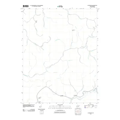
2011 Map of Lockwood
USGS Topo · Published 2011About this map
Fola and the Fola Post Office anchor the northern reaches of this terrain, where the industrial legacy is marked by Legg Road-Legg Mine. This part of West Virginia is defined by a dense network of drainages including Middle Creek and the many branches of Twentymile Creek. The southern corridor follows the path of Line Creek through the small communities of Lyonsville and Lockwood, tracing the low-lying areas near Upper Elk Hollow and Lower Elk Hollow. The landscape is a complex series of ridges and hollows, where local routes like Nicholas RD and Sycamore Creek RD connect isolated homesteads and mining sites. Named features like Boardtree Gap highlight the natural passes used to navigate this deeply dissected plateau during the early 21st century.
Find a feature on this map
48 named features on this map. Tap any name to fly to it.
Don’t see what you’re looking for? This feature index may not catch every label — zoom into the map to look around manually.
Map Details
Editions of this 2011 Lockwood Map
This is the sole edition of this map. No revisions or reprints were ever made.
Other maps of this area

1889 · Nicholas
USGS Topo · 1:125,000

1891 · Nicholas
USGS Topo · 1:125,000

1897 · Kanawha Falls
USGS Topo · 1:125,000

1900 · Kanawha Falls
USGS Topo · 1:125,000

1901 · Nicholas
USGS Topo · 1:125,000

1901 · Kanawha Falls
USGS Topo · 1:125,000

1908 · Clay
USGS Topo · 1:48,000

1908 · Fayetteville
USGS Topo · 1:48,000

1910 · Clay
USGS Topo · 1:62,500

1910 · Fayetteville
USGS Topo · 1:62,500