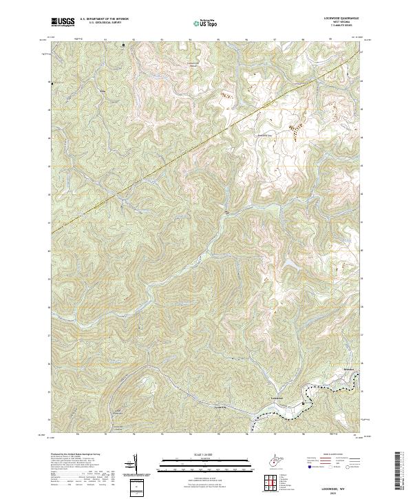
2023 Map of Lockwood
USGS Topo · Published 2023About this map
Lockwood and Drennen serve as the primary hubs of this West Virginia landscape, situated where Peters Creek and Line Creek carve through the deep valley systems of Nicholas County. The map details a complex network of hollows and gaps that defined the local geography and early industrial routes, such as Cannel Coal Hollow and Boardtree Gap. Small settlements like Fola and Lyonsville are linked by the winding Turnpike Rd, reflecting the historical transit patterns between the mountains.
Find a feature on this map
62 named features on this map. Tap any name to fly to it.
Don’t see what you’re looking for? This feature index may not catch every label — zoom into the map to look around manually.
Map Details
Editions of this 2023 Lockwood Map
This is the sole edition of this map. No revisions or reprints were ever made.
Other maps of this area

1889 · Nicholas
USGS Topo · 1:125,000

1891 · Nicholas
USGS Topo · 1:125,000

1897 · Kanawha Falls
USGS Topo · 1:125,000

1900 · Kanawha Falls
USGS Topo · 1:125,000

1901 · Nicholas
USGS Topo · 1:125,000

1901 · Kanawha Falls
USGS Topo · 1:125,000

1908 · Clay
USGS Topo · 1:48,000

1908 · Fayetteville
USGS Topo · 1:48,000

1910 · Clay
USGS Topo · 1:62,500

1910 · Fayetteville
USGS Topo · 1:62,500