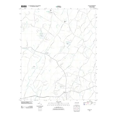
2010 Map of Locust
USGS Topo · Published 2010About this map
The settlement of Locust serves as a modern focal point at the junction of several regional routes, including Mission Church Rd and Meadow Creek Rd. This 2010 topographic record captures the landscape of southern Cabarrus County as it transitions toward more suburban development while maintaining deep ties to its agricultural and water-powered past. Significant water bodies such as Furr Lake, Smiths Lake, and Pharrs Lake are prominent, many tied to small-scale damming for local use. The Rocky River winds through the southwestern portion of the sheet, joined by tributaries like Anderson Creek and Little Meadow Creek. Historically significant sites like Barriers Mill and the community of Georgeville remain marked, alongside natural landmarks such as the Oak Cliffs overlooking Oak Cliff Lake. The abundance of family-named roads, including Reed Mine Rd and Hahn Scott Rd, offers clues for researchers tracing the evolution of local landownership and heritage in this Piedmont region.
Find a feature on this map
67 named features on this map. Tap any name to fly to it.
Don’t see what you’re looking for? This feature index may not catch every label — zoom into the map to look around manually.
Map Details
Editions of this 2010 Locust Map
This is the sole edition of this map. No revisions or reprints were ever made.
Other maps of this area

1941 · Charlotte
USGS Topo · 1:125,000

1942 · Charlotte
USGS Topo · 1:125,000

1949 · Midland
USGS Topo · 1:24,000

1949 · Concord SE
USGS Topo · 1:24,000

1950 · Concord
USGS Topo · 1:24,000

1953 · Charlotte
USGS Topo · 1:250,000

1954 · Charlotte
USGS Topo · 1:250,000

1957 · Mount Pleasant
USGS Topo · 1:62,500

1960 · Charlotte
USGS Topo · 1:250,000

1962 · Charlotte
USGS Topo · 1:250,000