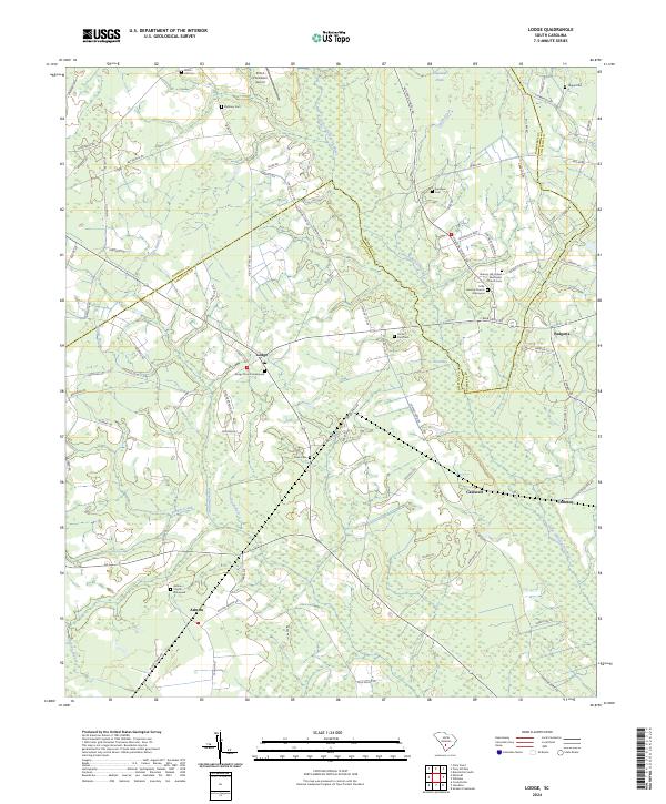
2024 Map of Lodge
USGS Topo · Published 2024About this map
Lodge stands as a focal point in this South Carolina Lowcountry landscape, situated where the Bamberg Co Colleton Co line intersects a network of agricultural roads. The terrain is defined by the slow-moving waters of the Little Salkehatchie River and its various tributaries, including McCuren Branch and Dry Branch. These watercourses carve through the timber and farmland, creating distinctive features like Horse Bay and Willow Swamp. The settlement pattern reflects a deeply rooted community, with numerous family-named graveyards and rural congregations serving the area.
Find a feature on this map
85 named features on this map. Tap any name to fly to it.
Don’t see what you’re looking for? This feature index may not catch every label — zoom into the map to look around manually.
Map Details
Editions of this 2024 Lodge Map
This is the sole edition of this map. No revisions or reprints were ever made.
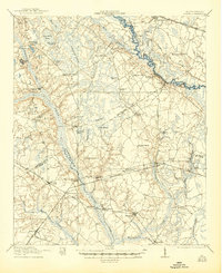
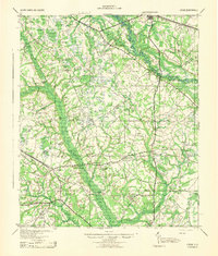
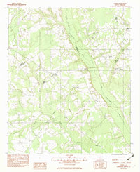
Historical Maps of Caldwell Through Time
6 maps found