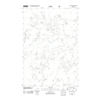
2011 Map of Lodge Point
USGS Topo · Published 2011About this map
Lodge Point and Pine Knob define the high terrain of this Idaho County landscape, which is drained by an intricate system of mountain waterways. The hydrology of the region centers on Clear Creek and its significant tributary, the Middle Fork Clear Creek, which carve through the land alongside dozens of smaller named flows like Swiftwater Creek and Browns Spring Creek. This 2011 survey by the U.S. Geological Survey illustrates a remote area dominated by Forest Service management, where the primary human infrastructure consists of named mountain tracks such as Lookout Butte Rd and Nat For Dev Rd 1113. Researchers will find a preserved look at the Idaho wilderness at the start of the 21st century, showing how drainage patterns from Tahoe Creek to Newsome Creek dictate the local topography and the placement of high-elevation observation points like Lookout Butte.
Find a feature on this map
20 named features on this map. Tap any name to fly to it.
Don’t see what you’re looking for? This feature index may not catch every label — zoom into the map to look around manually.
Map Details
Editions of this 2011 Lodge Point Map
This is the sole edition of this map. No revisions or reprints were ever made.
Other maps of this area

1924 · Weippe
USGS Topo · 1:125,000

1931 · Buffalo Hump
USGS Topo · 1:125,000

1934 · Buffalo Hump
USGS Topo · 1:125,000

1956 · Elk City
USGS Topo · 1:250,000

1956 · Hamilton
USGS Topo · 1:250,000

1959 · Hamilton
USGS Topo · 1:250,000

1960 · Elk City
USGS Topo · 1:250,000

1960 · Hamilton
USGS Topo · 1:250,000

1962 · Iron Mtn
USGS Topo · 1:24,000

1962 · Pilot Knob
USGS Topo · 1:24,000